It’s been almost 2 weeks since my ride in Los Gatos, and three weeks since the Shelter In Place order went into effect here in California. The Los Gatos Ride was WAAAY too crowded for my taste, and I’m going nuts not being able to ride.
Getting There
Last week, I posted a fairly prominent video about how much I was bothered by the number of people I passed on a short local trail. (161, in case you were wondering). I felt like I would be acting like a hypocrite if I went to ride another crowded local trail the very next week, so I started doing some homework.
After lots of study and input from readers, subscribers, and friends (thanks for all the replies), I decided that I should check out one of two locations for my next ride; Henry Coe State Park or Calero County Park. Both are located a few miles south of San Jose, and both are somewhat remote, making it more likely that I might run into other people when I get there.
Henry Coe is a HUGE park (over 87,000 acres) that lies in the hills to the east of Morgan Hill, California. While it is usually a hot, dry place to ride, our wet Spring has made the hills green. The air still has a chill in the mornings, so an earlier ride might be perfect at Henry Coe. But there are other issues at play.
The city’s updated shelter-in-place order is requiring two things that make riding more difficult:
- All state parks are closing their parking lots
- All outdoor recreational activities must be within the resident’s home county, and can be no farther than 5 miles from home
Point #1 kills Henry Coe as an option. The parking lot is pretty hard to get to without an automobile. It is located at the top of a tough uphill climb. Parking at the bottom of the mountain and riding to the park entrance is an entire ride in and of itself. And it’s all paved.
Calero is a more realistic option. While it is also located inside Santa Clara county limits, it is much closer to me. In fact, it is actually within 5 miles of one of my residences. If I fudge the rules a little bit, it’s actually okay for me to ride (providing I follow proper social distancing rules, of course).
Sunny Valley
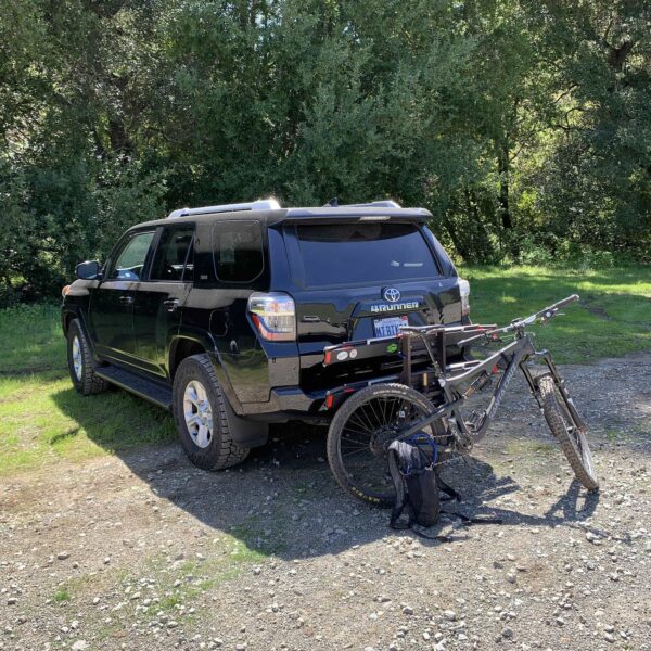
The park was in amazing condition. After the recent rains, I was worried it might be wet and muddy. The drainage is excellent and the parking areas are smooth and dry. A ranger approved of my route and let me know that, while the primary parking lot was full, the visitors were primarily hikers that were keeping to the local trails in and around the parking area. I wouldn’t be running into very many of them on the more distant trails. Also, the park service recently made the trail route one-way. This eliminated the chance of crossing paths with other riders on my loop. He later directed me toward a more remote secondary parking lot where I could pull the bike off the truck without being too close to other park visitors.
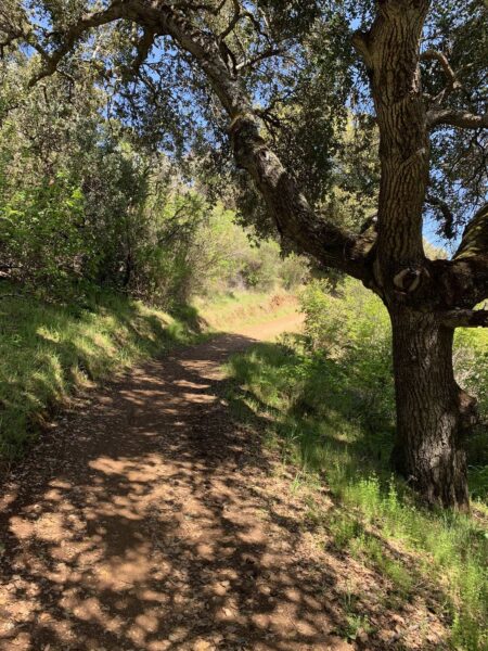
I geared up and rode out. The initial climb up Mayfair Ranch, the first hill, was well maintained and in fantastic condition. The brush was green, the trees were shady, and the sky was blue. Perhaps it’s the clean air talking, but it was a perfect trail if I ever saw one.
These climbs are steep, but could be a lot steeper. There are many switchbacks carved into the mountain which help with the grade of the climb. I cannot imagine how tough this would be to ride straight up.
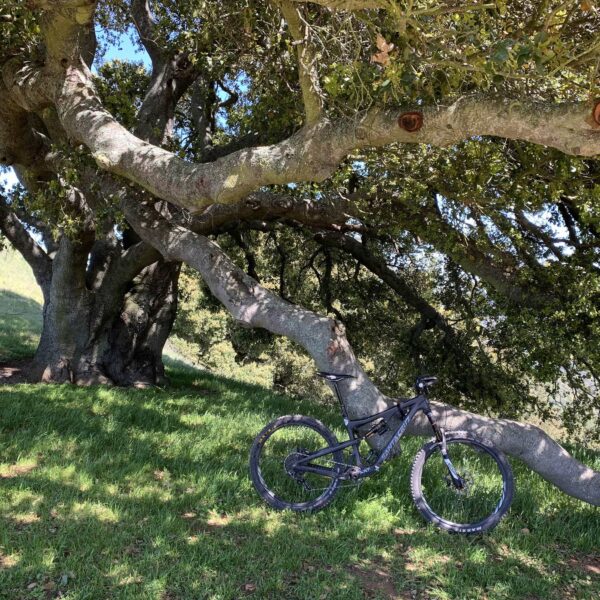
Approaching the top of the first summit, the trail leveled off a bit and started to roll along the ridge. Sun and shade mixed as the oak trees and manzanita hung over the trail and turned it into a fantasyland. At the top, there was a picnic table with a big sign taped to it: “SURFACES ARE NOT DISINFECTED!” These guys aren’t leaving anything to chance.
The ride down the first hill was slower than I’d like. It was filled with hard corners, some off camber, and I had never been on this dirt. I had no idea what was coming up. So I rode carefully. There were fast and technical sections. The bottom had some super-fun rolling trails in the shade that felt like something out of a Disney movie.
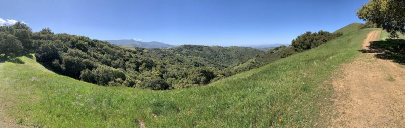
The second climb up the upper section of Longwall Canyon Trail was considerably tougher than the first. It was also very easy to complete if one had some experience with long climbs and can handle some of the more technical bits. There is a spot in the middle that contains some rolling downhill and provides a fantastic respite between the longer pulls. Overall, I’d rate it a 7/10 in difficulty and a 10/10 in beauty. Towards the top, it was easy to see across the gap to the trail I had used to descend down from the first summit.
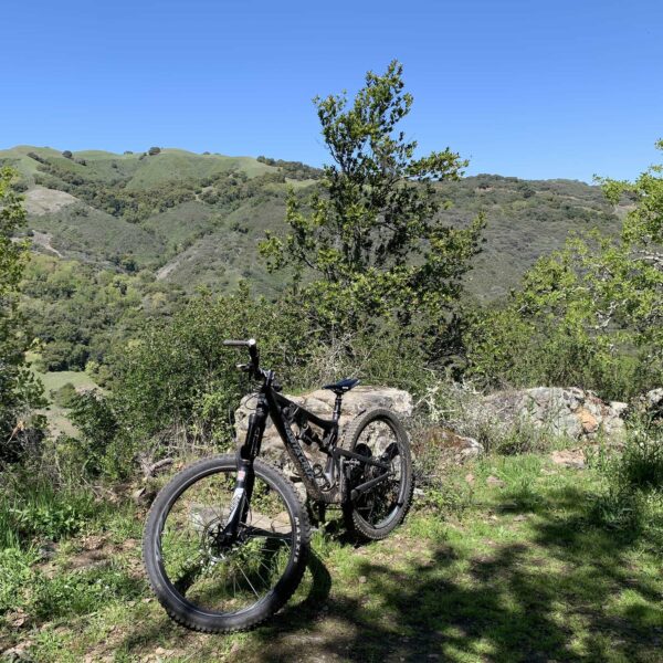
At the top of the main peak, the trail turns right onto the Bald Peaks Trail. This is a wide fire road that follows the summit east-to-west, and looks like it may enter into some off-limits property on its west end. (I’m not really sure about this, different maps tell me different things). There is a picnic table and a beautiful shady oak at the top. I relaxed and took in the incredible view of the surrounding hills, wildflowers, and clean air and south San Jose peeking between the grassy slopes.
After about 15 minutes of watching the hawks ride the thermals around the mountain tops, I pressed on and up. The immediate tippy top of the hill after the shady tree was short but incredibly steep. I got up it, but I was breathing pretty good afterwards. There was a small side trail which one could use to access the very top of a high spot on the hill, but I left that for another day.
The Bald Peaks Trail rode east and eventually came to a branch on the right side. The Catamount Trail is another fire road that steeply drops back down towards the Canyon Del Oro base area where I parked.
It was a fun and, at times, fast descent through shaded glades and open fields. Once again, it was hard to get up too much speed because of the curves on the road, but it was still a lot of fun! Some spots were a bit confusing, looking like trail forks. The general rule is to stay on the “main” trail and head downhill. There are some signs along the way which help a little bit.
At the bottom, I splashed through a shallow creek and took the road back to the lot. It was an easy ride back to the truck where I loaded up the bike and took in the beauty of the Mountain Home area one last time.
Recharged
It felt GREAT to get out, and it was a treat to be able to do so on such a perfect day. It is rare to be able to enjoy the green hills in the Spring because it so often too wet to ride while the hills are as lush.
I hope I’m able to enjoy this much solitude again soon. I hope you can also.